























OPINION Tasks Ahead C’River Lands Commissioner

By Isaac Aqua
The recent cabinet reshuffling by Governor Bassey Otu, culminating in the redeployment of Dr Erasmus Ekpang from the Ministry of Information to the Ministry of Lands as Commissioner, comes at a defining moment for land administration in Cross River State.
The office carries responsibilities far beyond the routine processing of land documents, approval of building plans and allocation of plots in Government Reserved Areas, GRAs. At a time when rapid urbanisation, environmental degradation and unplanned settlements are reshaping the state’s landscape, the Ministry of Lands must become an active instrument of development, safety and environmental protection,rather than a passive spectator.
Dr Ekpang therefore has an enormous task ahead. His targets must transcend the volume of files processed, approvals granted or social media publicity generated. The real measure should be how effectively he can rejig the ministry to bring order and sanity to the state’s expanding but increasingly chaotic urban spaces, protect public land, safeguard communities from environmental hazards and provide a credible framework for sustainable development.
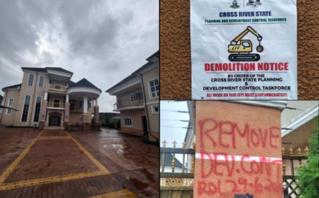
Cross River is not short of professional manpower to undertake this responsibility. The Ministry of Lands has a reservoir of geologists, surveyors, estate valuers, civil engineers, builders and town planners. Yet, these professionals appear to be grossly underutilised in a system often perceived as being preoccupied with approvals and the familiar red paint used to mark unapproved buildings.
That approach is no longer sufficient.
Land administration must be proactive rather than reactive. The ministry should urgently embark on comprehensive mapping of the state to determine the suitability of land for residential, commercial, agricultural and industrial purposes. Such mapping would provide government with an indispensable planning instrument for identifying floodplains, ravines, landslide prone areas, drainage channels, access corridors and other environmentally sensitive locations.
The principle is simple: land often gives warning before it fails. A properly designed mapping system can reveal the physical characteristics and vulnerabilities of an area before development takes place. With accurate maps and reliable geological and environmental data, the Department of Town Planning can prevent buildings from being approved in locations where human lives and property could eventually be endangered.
The devastating landslides witnessed in parts of Calabar should serve as a painful reminder of the consequences of poor planning. The situation in Ikot Awatim, Ekorenim, Ikot Effanga, Ikot Eneobong, Enima and Ikot Omin, where residential development has occurred in or around ravines and environmentally vulnerable areas, demands urgent attention. The lesson from these locations should not be another round of emergency responses after disaster strikes. It should be prevention.
This is where the ministry must rethink its priorities.
The era when community leaders independently carved out land, partitioned plots and sold them without recourse to government must end. Government cannot continue to bear the burden of mitigating calamities arising from such unregulated development when it was not involved from the outset. This practice has contributed to congested and unplanned residential layouts without proper drainage channels, access roads and other vital infrastructure.
Henceforth, every emerging residential layout should be properly assessed before development begins. Access roads must be mapped and connected to existing road networks. Adequate drainage systems must form part of the planning process rather than being improvised after houses have been constructed. Emergency corridors should also be incorporated into layouts to allow fire service personnel, ambulances and other emergency responders to reach communities without unnecessary delays.
It is troubling that some residential areas in Calabar lack adequate access routes for emergency response. In a city where population and construction are expanding, this is not merely a planning inconvenience. It is a potential threat to lives.
The ministry must also insist that emerging layouts are submitted for proper planning assessment and charting. No developer should be permitted to create a residential estate in isolation from the broader development plan of the state. Cross River needs a coherent spatial development strategy that recognises the relationship between housing, roads, drainage, agriculture, industry, commerce and the environment.
Equally important is the need to address the indiscriminate excavation of sand and laterite. Unregulated borrow pits and uncontrolled excavation around Calabar and other parts of the state can alter natural drainage patterns, weaken the landscape and create dangerous depressions. Construction activities cannot be allowed to generate revenue or private profit today while leaving government and communities to bear the environmental consequences tomorrow.
The Ministry of Lands must move from being a glorified bystander to cultivating robust synergies with agencies responsible for the environment, urban development, public works, emergency management and infrastructure. Its professionals should be deployed to monitor road and drainage construction across the state and prevent a recurrence of the landslides around Diamond Road and the gully erosion ravaging Ikot Nkebre, Nyanassang and other parts of Calabar, which can be linked to poorly designed or executed construction works. They should also provide technical assessments before major developments are approved, rather than merely being invited to respond when problems have become too obvious to ignore.
Community leaders should also become important partners in this process. A robust relationship between the ministry and traditional rulers, community associations and other local stakeholders can provide valuable information about the history and physical characteristics of communities. Residents often know where water naturally flows, where erosion begins, where the soil becomes unstable and where flooding has occurred over generations. Such knowledge, combined with professional scientific assessment, can strengthen planning decisions.
The challenge extends beyond Calabar. Ikom, Ogoja, Ugep, Obudu, Yala, Akamkpa, Akpabuyo, Odukpani and other growing communities require deliberate land management policies before uncontrolled expansion makes proper planning more difficult and expensive.
Cross River cannot afford a land administration system that waits for buildings to spring up before asking whether the land was suitable for development. The state needs a ministry that anticipates growth, identifies risks and creates the conditions for safe and orderly development.
This is an enormous assignment for Dr Ekpang. It is not an assignment for cheap social media applause or unnecessary accolades designed to manufacture popularity. It requires a commissioner who will spend time on the ground, consult professionals, visit communities, study maps and confront the state’s land management challenges.
The ultimate measure of his tenure should be whether Cross River emerges with a more organised, safer and better mapped landscape. The ministry must move from merely approving development to shaping it. It must protect land as an economic asset, an environmental resource and a foundation for human habitation.
Dr Ekpang has the opportunity to make land administration one of the defining pillars of the state’s development agenda. The time to begin is now, before another warning from the land becomes another disaster.